Streamline construction planning, design, and monitoring with our advanced 3D drone mapping services. Our high-accuracy maps provide detailed insights, allowing you to make informed decisions and ensure the success of your projects.
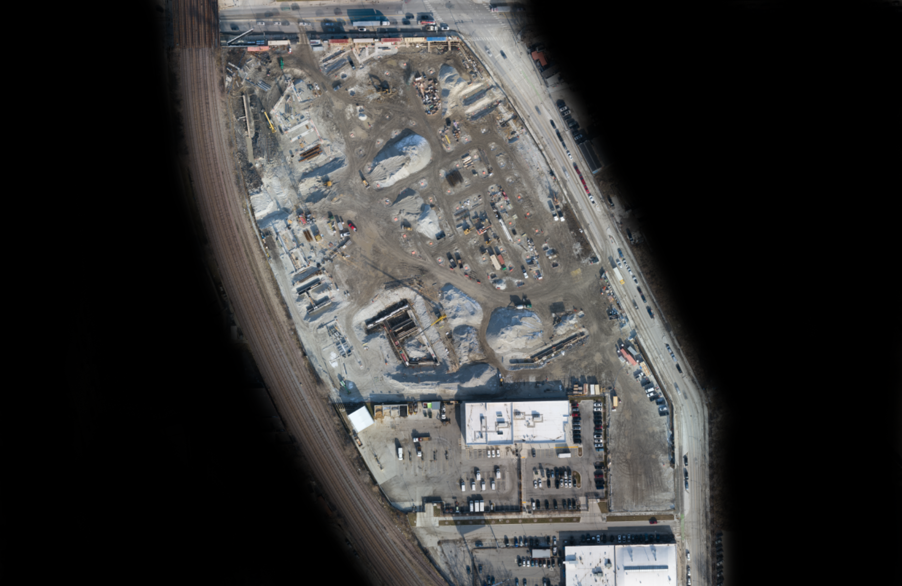
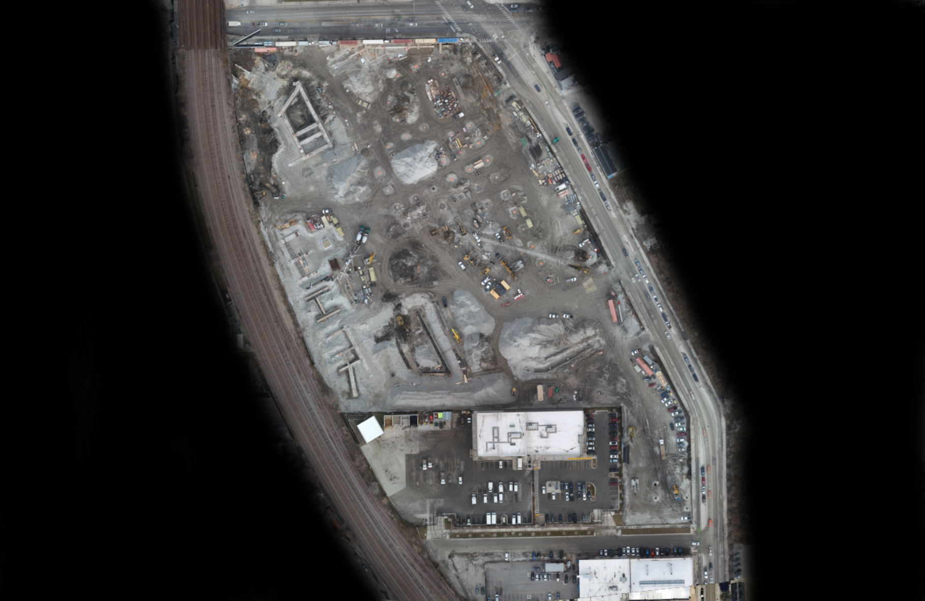
Constructtion progress monitoring at 1237 W Division, Chicago, IL
Use the slider to compare the changes
Our progress monitoring service can help you document stages of construction to keep project stakeholders up to date without the need to physically visit the job site.
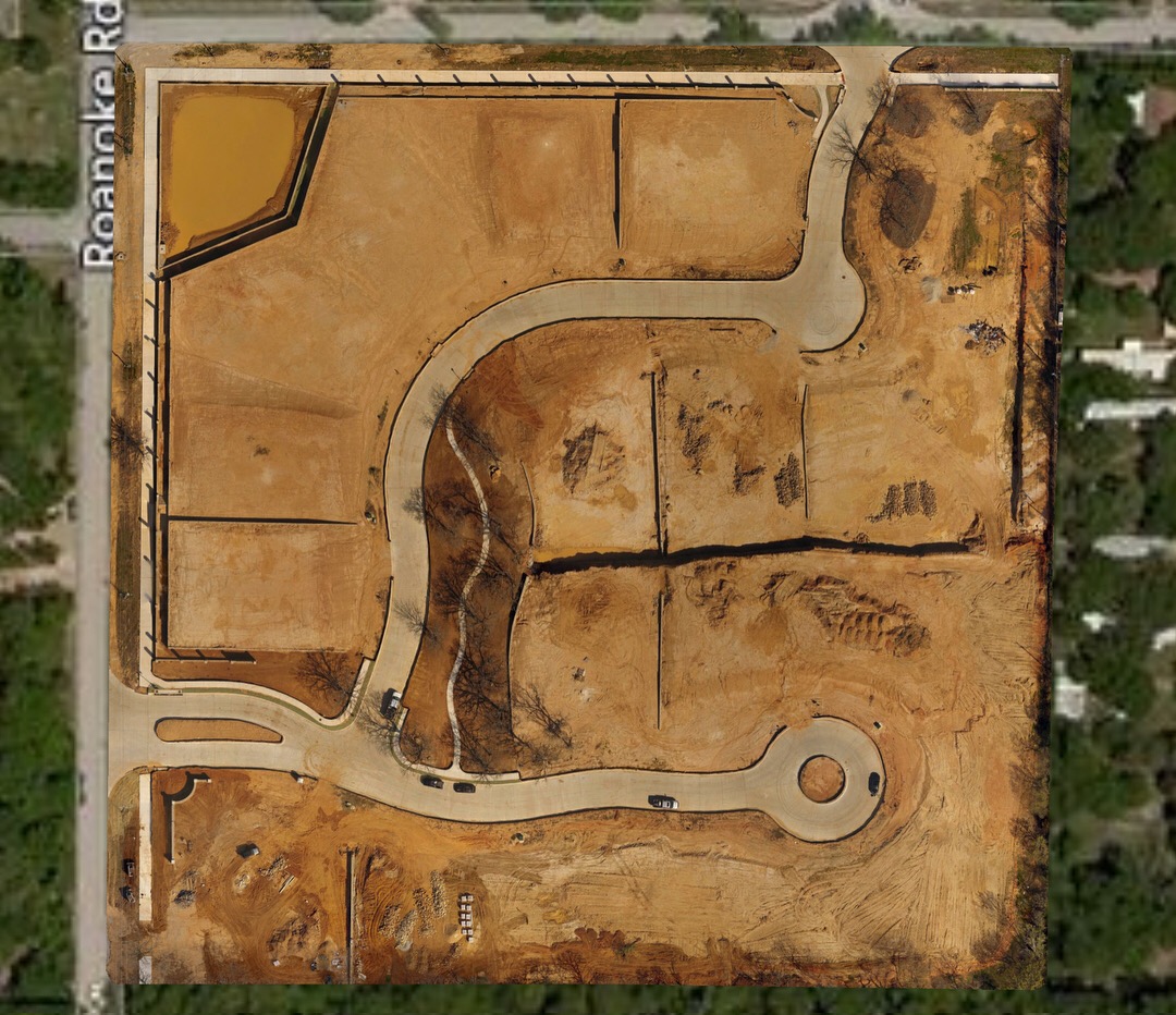
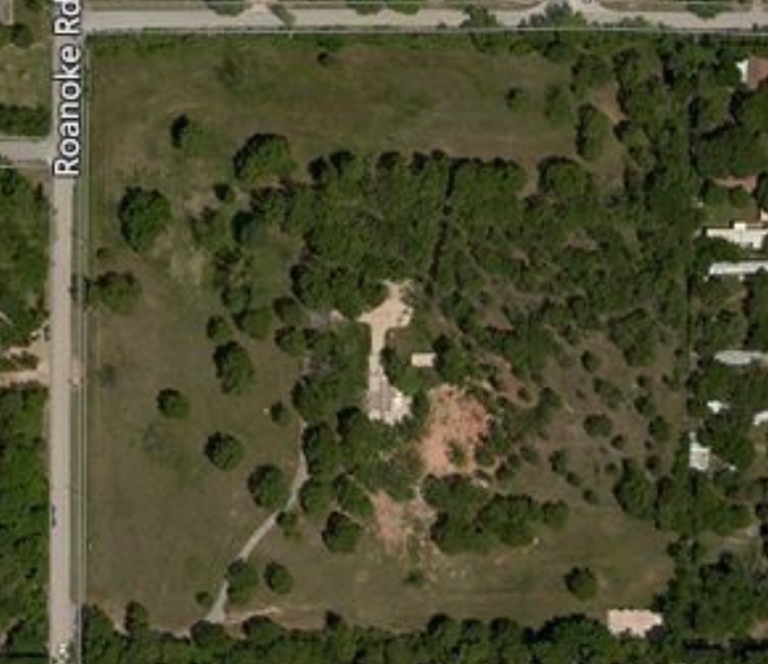
Our Orthomosaics vs Google Earth
Our aerial maps are higher resolution than Google Maps and also more up to date. With Google Earth, you have a limited zoom level and most maps are weeks if not months out of date.
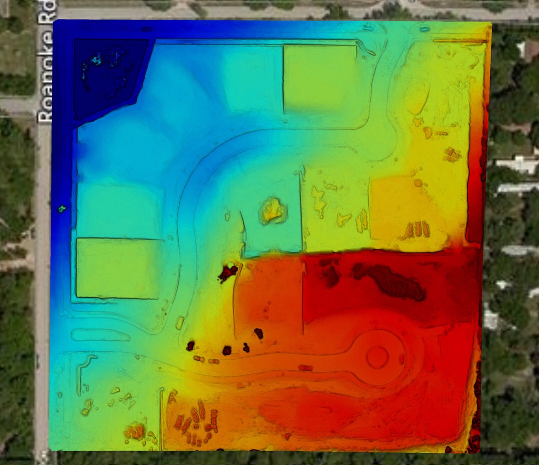
Drone to DEM


Your turn to make a move
Like Nothing You've Seen Before. Contact Us Today To Learn More.
Contact Us For A Free Demo!