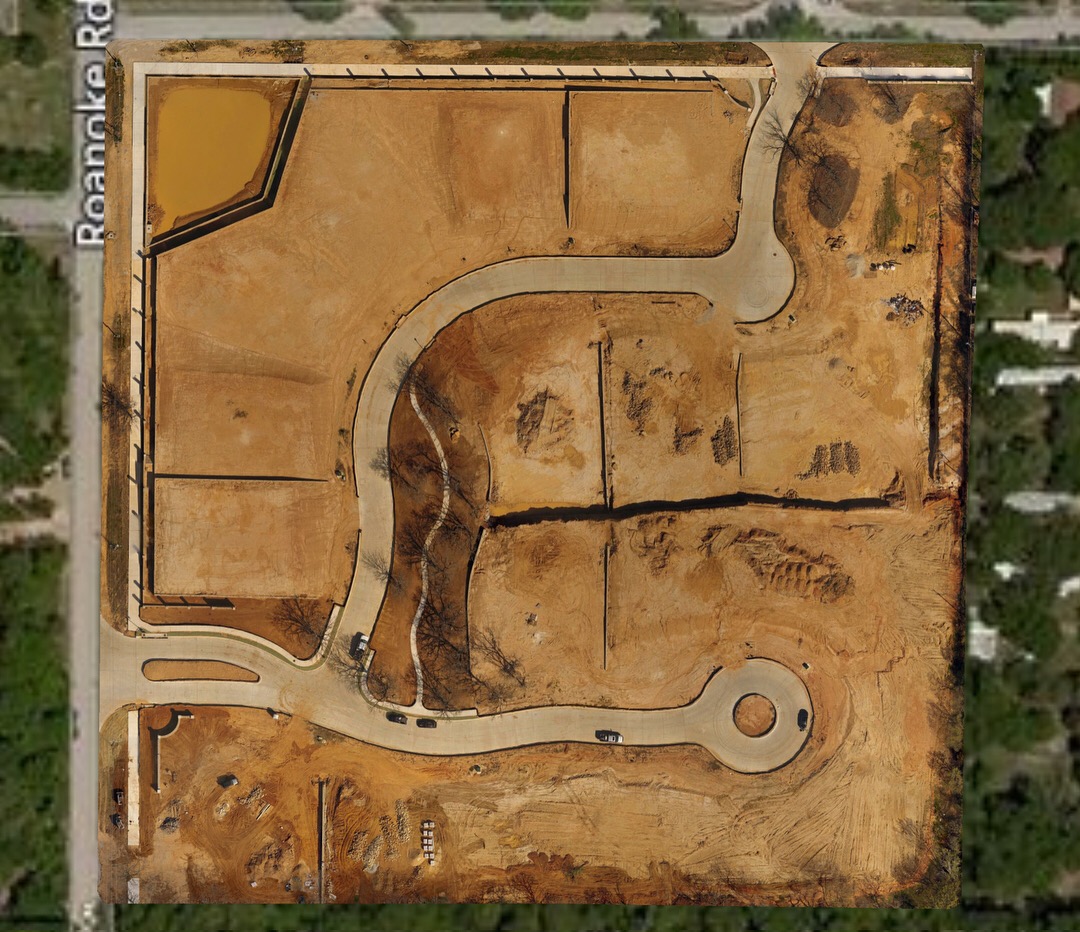
Drone mapping mission at the new 13 acre Oakbrook Hills subdivision development in Keller, TX.
The first image is the high-resolution orthomosaic created from hundreds of aerial photos using automated drone technology.
The second image is the digital elevation map (DEM).
The third is the low-resolution Google map of that same location.
The fourth is the project CAD plans(courtesy of the developer)

High-resolution orthomosaic created from hundreds of aerial photos using automated drone technology

Digital Elevation Map

Low resolution out of date Google Map of the same location.

Project plans courtesy of the developer