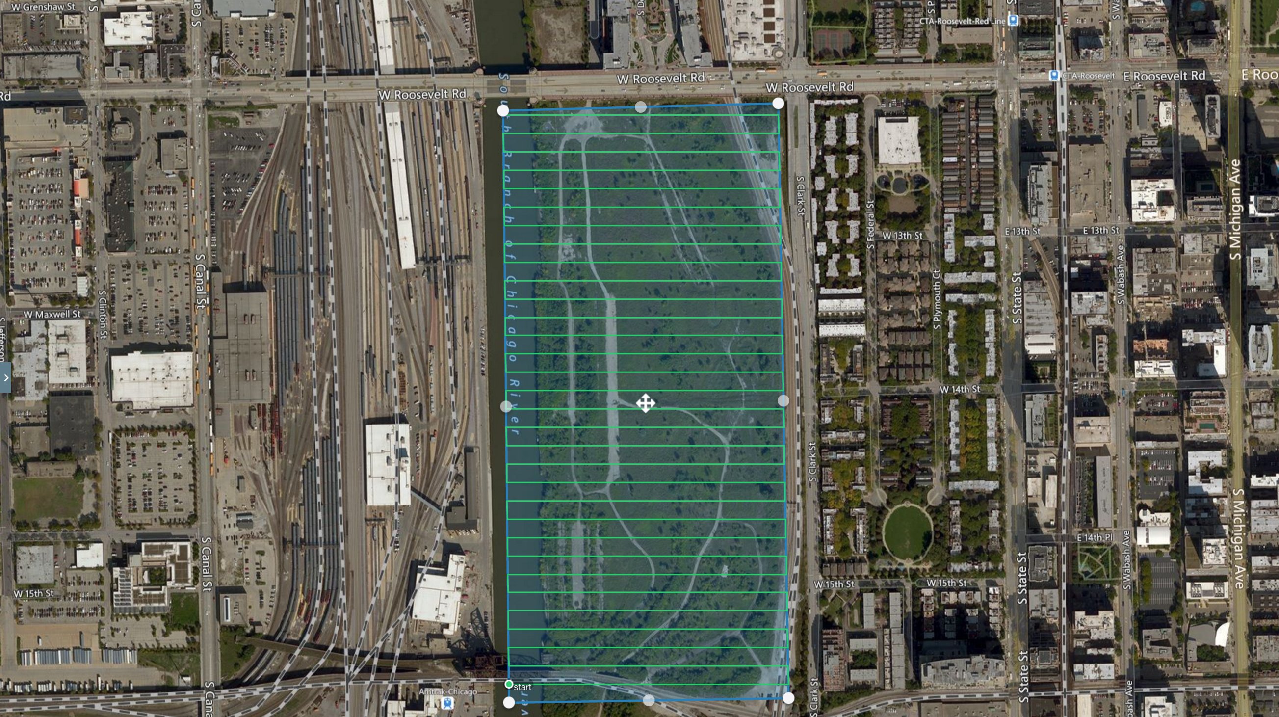
Last week Helios Visions worked with Related Midwest, a Chicago real estate development company who just signed a deal to build a 62-acre neighborhood linking the South Loop and Chinatown.
This particular project involved producing an aerial map of the property to be utilized during the safety and planning process and later supplement the land survey crew and other stakeholders.
Using automated flight planning software and high-resolution sensors, the property was mapped and geospatial intelligence was collected. This data will be used to aid in the multi-year property development.
THE PLAN
After initial planning is finished, the flight plan is mapped out, and pilots do a safety inspection of airspace to evaluate any potential safety hazards.
In order to capture the whole 62-acre property in one ultra high-resolution image, hundreds of single geotagged photos are taken. This project included 441 photos, and each respective photo is used to ensure imagery and other data is collected in its entirety.
Finally, pilots begin a flight simulation to determine the number of images required for proper coverage. During this time, pilots also map the exact time of flight and best location for swapping batteries.
The 62-acre site with the flight plan overlay

FLY – “Aerial Data Collection”
The aerial data collection mission is launched following a site walkthrough and strict preflight checklist.

Chief Pilot Tyler Gibson on the job site
DATA PROCESSING
After the aerial data is collected, it is processed and analyzed to create the georeferenced maps below.
These products can be used throughout the real estate development process as a reference and benchmark of what the property looked like before development.
Orthomosaic
After the aerial data is collected, it is processed and analyzed to create the georeferenced maps below.
These products can be used throughout the real estate development process as a reference and benchmark of what the property looked like before development.
Digital Elevation Model
3D Model
Deliver
The aerial maps and other location data were delivered to the client within 24-48 hours for most projects.
We welcome the opportunity to answer any questions about our drone-based aerial data collection services feel free to contact us here


